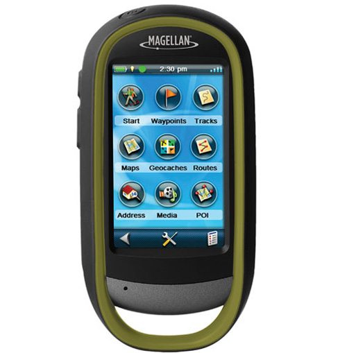
Magellan introduced three new GPS devices today as part of their Explorist line, with some interactive features perfect for outdoor explorers. In addition to GPS navigation, the Explorist 710, 610 and 510 all take 3.2MP photos that are automatically geotagged for location, which can be viewed on its 3-inch LCD touchscreen. You can also record audio notes on specific locations with the included microphone. Each receiver is IPX-7 certified for waterproof use (up to 3.3 feet of water for 30 minutes), and they’ll be available in a World Edition which has maps of US, Canada, Western Europe and Australia.
The 710 features Magellan’s Summit Series topographic map as well as the City Series turn-by-turn map for cities. The 710 and 610 include a three-axis electronic compass, with a barometric altimeter that measures accurate elevation tracking and weather updates.
The Magellan Explorist 710, 610, and 510 will be available this year for $350, $450 and $550, respectively.
GPS Explorist Line
Published on July 27, 2010


