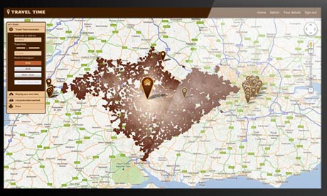
The winner of the UK Satellite Navigation Competition tells you how long will it take to get there, by any mode of transport.The next time you’re looking for a place to buy or rent, will you choose it by the distance from where you work – or by the time it takes you to get to work by bus, train, tube or car? Most people actually want to choose by the latter. Now a British company called iGeolise is promising to commercialise that idea for all modes of transport – and expand it from the UK to Europe and the US.
Since this summer it has already helped TalkTalk decide where it ought to relocate its offices to – when it was considering moving a thousand employees – and a major high street store is considering offering it on its site to help web searchers find their nearest outlet, measured by time rather than the usual distance as the crow flies. The market for such a service is growing: rival Mapumental offers time-based maps for travel on public transport.
iGeolise has the momentum at present, having just won the UK Satellite Navigation Competition, organised by the University of Nottingham’s GNSS Research and Applications Centre of Excellence, is poised to start offering location search services for all sorts of companies – and could come to the attention of mapping giants, including Google,Nokia and Apple, all of which have hundreds of millions of users.
he output from iGeolise could be fed straight to a smartphone, he suggests, via the paid-for API the company is developing. While Mapumental also has an API under development, most users see its output in the form of rendered images on its web page.


